ABOUT PT SURYA KWON SUNG
–
WHEN ACCURACY MATTERS
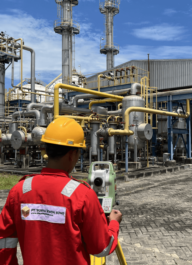
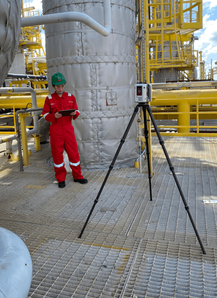
Founded in 2003 to support Indonesia’s petrochemical industry with equipment sales, maintenance, and industry-related surveys, PT SURYA KWON SUNG (PT SKS) has become a trusted provider of 3D laser scanning, laser tracker measurement, as-built modeling, and dimensional inspection across diverse sectors—including digital twins, reverse engineering, industry & energy, mining & tunneling, civil engineering & architecture, and marine & offshore industries. Operating one of Indonesia’s largest fleets of 3D laser scanners, laser trackers, and portable CMMs, our teams deliver reliable, high-precision measurement data for critical assets across the country.
Building on this hands-on expertise, in 2025 PT SKS became an authorised distributor of Hexagon Manufacturing Intelligence in Indonesia. We supply and integrate Hexagon’s full range of metrology solutions, including portable measuring arms, laser tracker systems, coordinate measuring machines (CMMs), handheld 3D laser scanners, and structured light scanners. We also offer industry-leading software—such as PolyWorks, Geomagic, PC-DMIS, Inspire, and TrueProp—enabling rapid conversion of measurement data into models, inspections, and reports. From live demonstrations to calibration, operator training, and technical support, we guide you smoothly from purchase to full operation, helping you work with greater confidence and efficiency.
WE ARE ALSO A SERVICE PROVIDER
Beyond supplying Hexagon’s cutting-edge equipment, PT SKS offers comprehensive on-site measurement services across Indonesia. Our certified engineers arrive with terrestrial 3D laser scanners, metrology-grade handheld 3D laser scanners, measuring arm CMMs, laser tracker CMMs, total stations, RTK GNSS rovers, ground penetrating radars (GPRs), cable & pipe locators, handheld LIBS analyzers, handheld XRF analyzers, and ultrasonic thickness gauges to capture, model, and verify everything from single components to large-scale industrial plants—delivering accurate as-built 2D and 3D measurement data. Our as-built deliverables include:
When accuracy is non-negotiable, we perform machinery alignment and inspection using laser tracker CMMs, measuring arm CMMs, and metrology-grade handheld 3D laser scanners.
For clients who prefer to handle post-processing in-house, we deliver clean, registered point clouds in color or black & white—ready for modeling, measurement, and analysis.
Scan to Mesh: From 3D laser scan data, we create clean, detailed 3D mesh models in a range of 3D mesh formats—ideal for visualization, reverse engineering, and digital archiving.
Scan to CAD: Using 3D laser scan data, we reverse engineer accurate as-built 3D CAD models—capturing complex geometry for redesigns, part replication, tooling, and component fit-up.
Scan to BIM: As-built BIM models are developed from 3D laser scan data, providing a true-to-field 3D model of current conditions for engineering, coordination, and construction.
Scan to Plant: Detailed plant design models and piping isometric drawings are produced from 3D laser scan data to support retrofit work, layout validation, and engineering deliverables.
Using 3D laser scanning, we generate accurate tank inspection and calibration reports for aboveground and underground storage tanks, supporting compliance, verification, and documentation.
For fast, high-accuracy volume measurements, we perform volumetric surveys with 3D laser scanning—ideal for storage tanks, ship ballast & fuel tanks, and material stockpiles.
Clear as-built 2D CAD documentation is created to match your standards—including engineering, architectural, and inspection drawings tailored to your project requirements.
By comparing design models to point clouds (or point clouds to each other), we deliver clash detection and deviation checks that reduce rework and confirm field conditions.
To quantify deformation and wear, we create high-resolution 3D color maps using 3D laser scanning and/or CMM measurements—making changes easy to visualize and report.
Utilizing 3D laser scanning, we generate accurate 2D & 3D topographic models. Additionally, with GNSS RTK rovers, we georeference your project data to real-world coordinates.
Ground penetrating radar (GPR) provides underground mapping in both 2D and 3D, helping identify subsurface features and utilities with clear, usable results.
With 3D laser scanning and TrueProp Software, we deliver fast, accurate propeller inspections in accordance with ISO 484 tolerance standards—supporting repairs and verification.
By leveraging 3D laser scanning, real-world objects and environments become high-quality digital 3D models—ideal for VR, AR, simulation, visualization, and 3D digital content creation.
We use handheld LIBS and XRF analyzers to accurately identify materials, including carbon content for steel grade identification, and ultrasonic thickness gauges to precisely measure thickness.
Have Questions?
Feel Free to Contact Us!
We offer demos, application advice, quotations, installation, training, and service across Indonesia. Share your application, tolerances, and budget—we’ll propose the most effective solution.